![]()
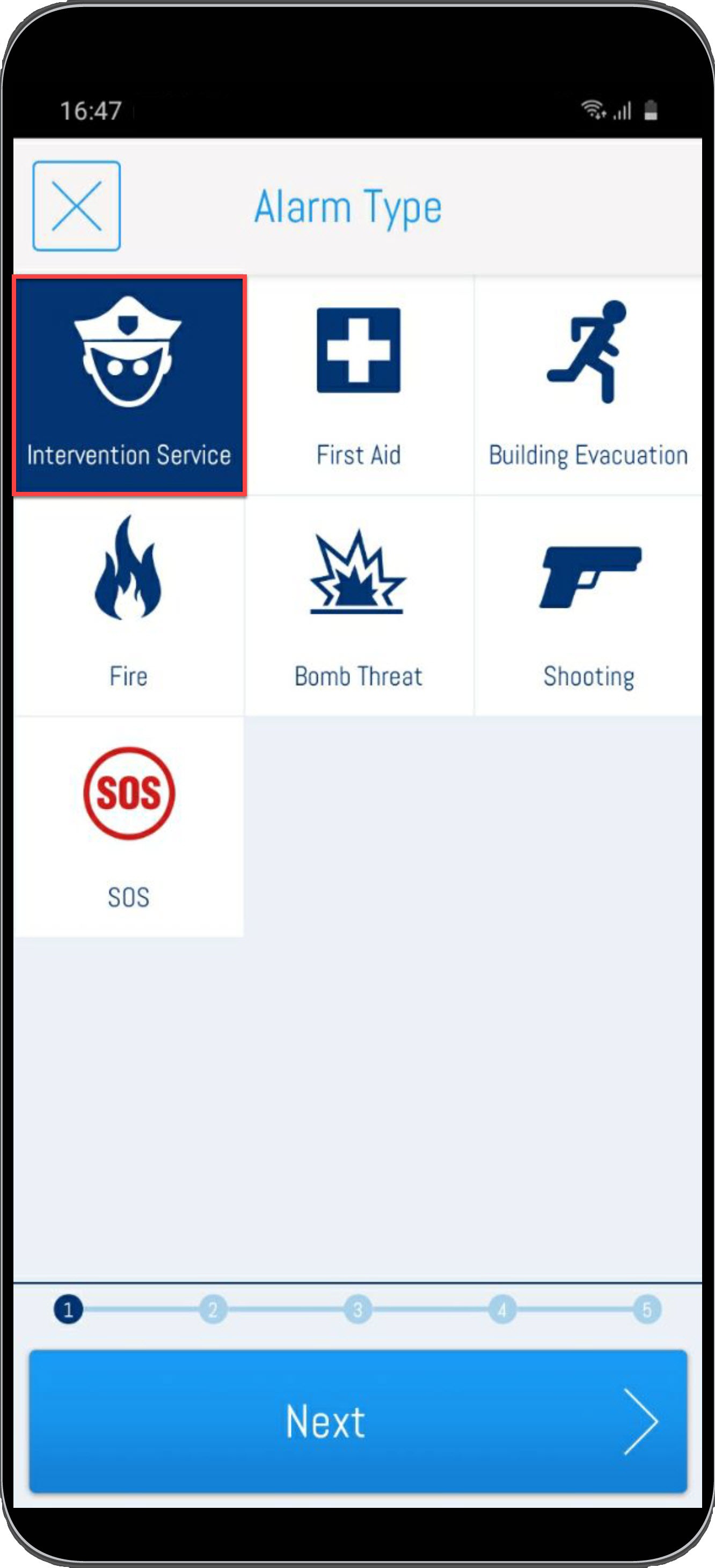
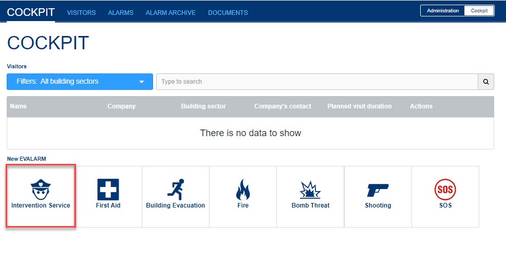
Create Alarm
After successful configuration, the alarm can be started via the app or the Web Cockpit.
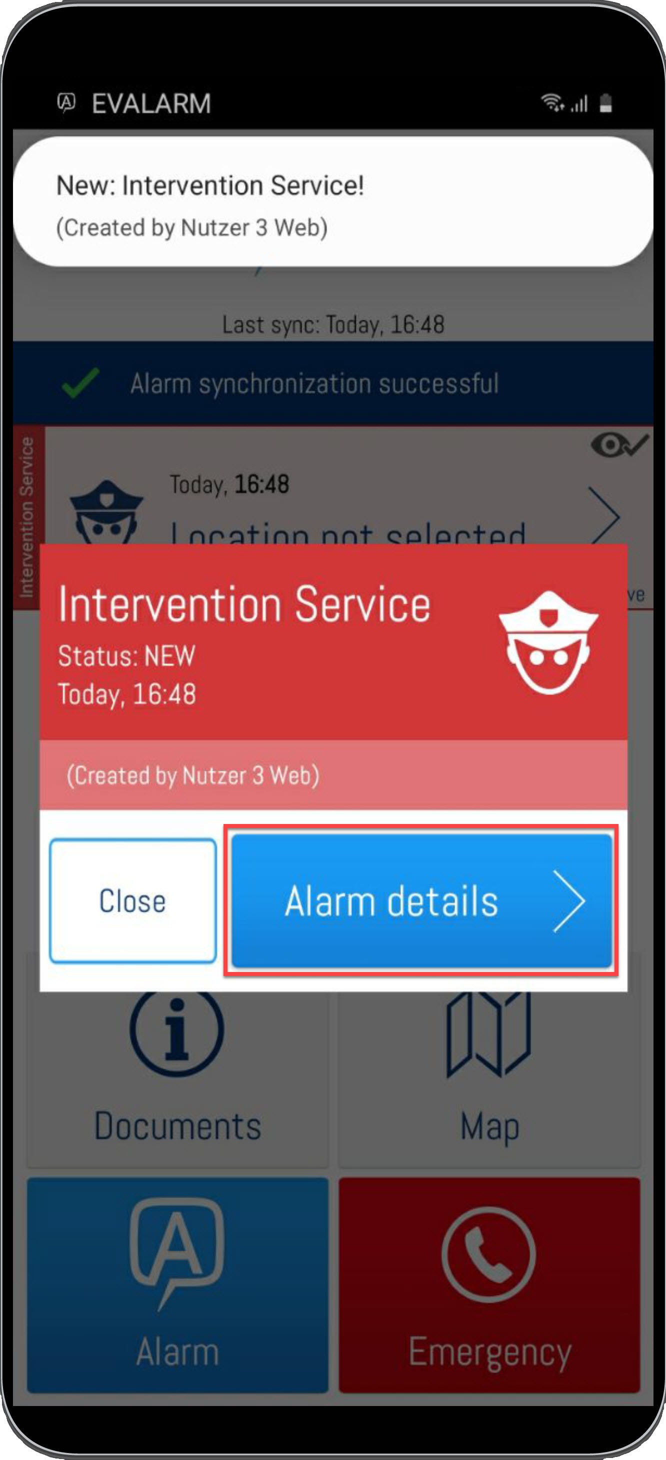
Starting Intervention Service
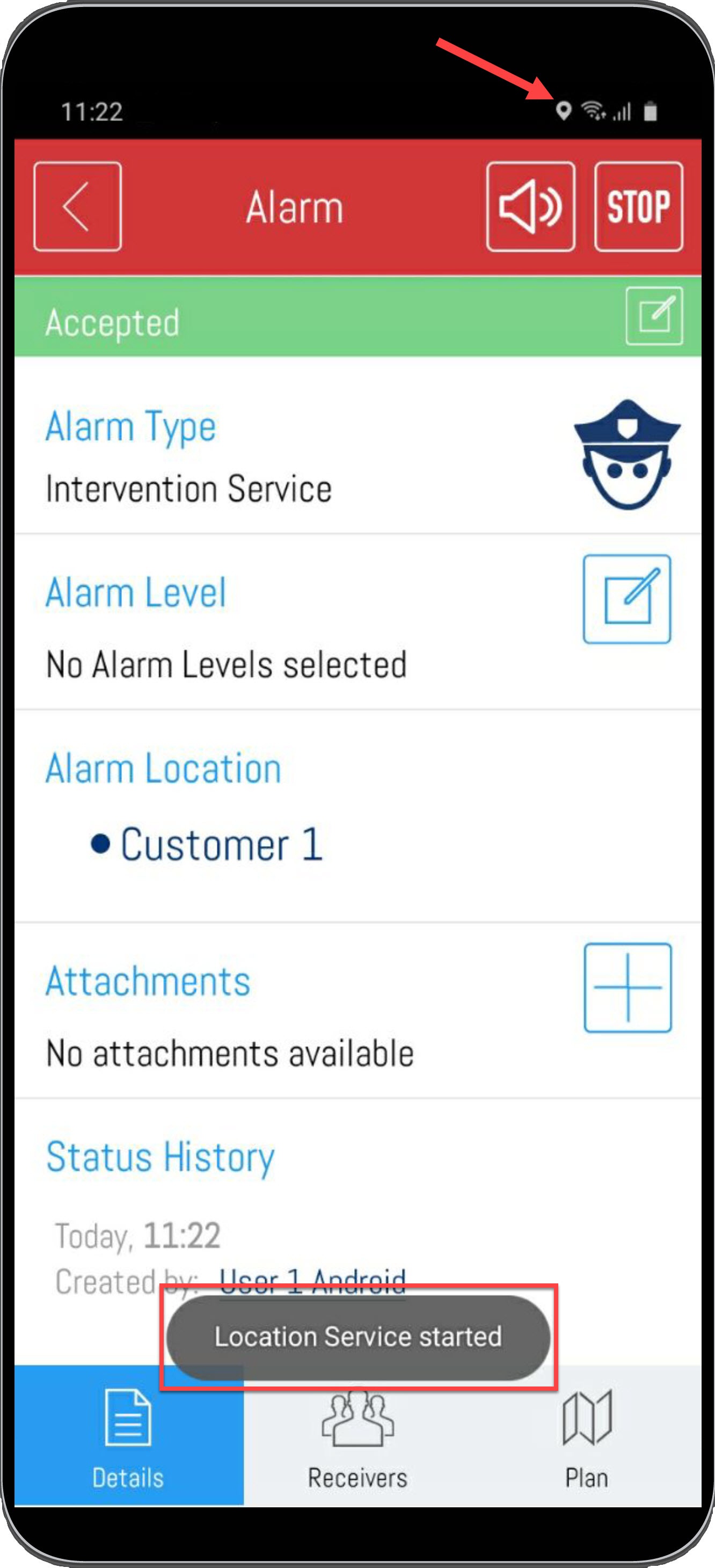
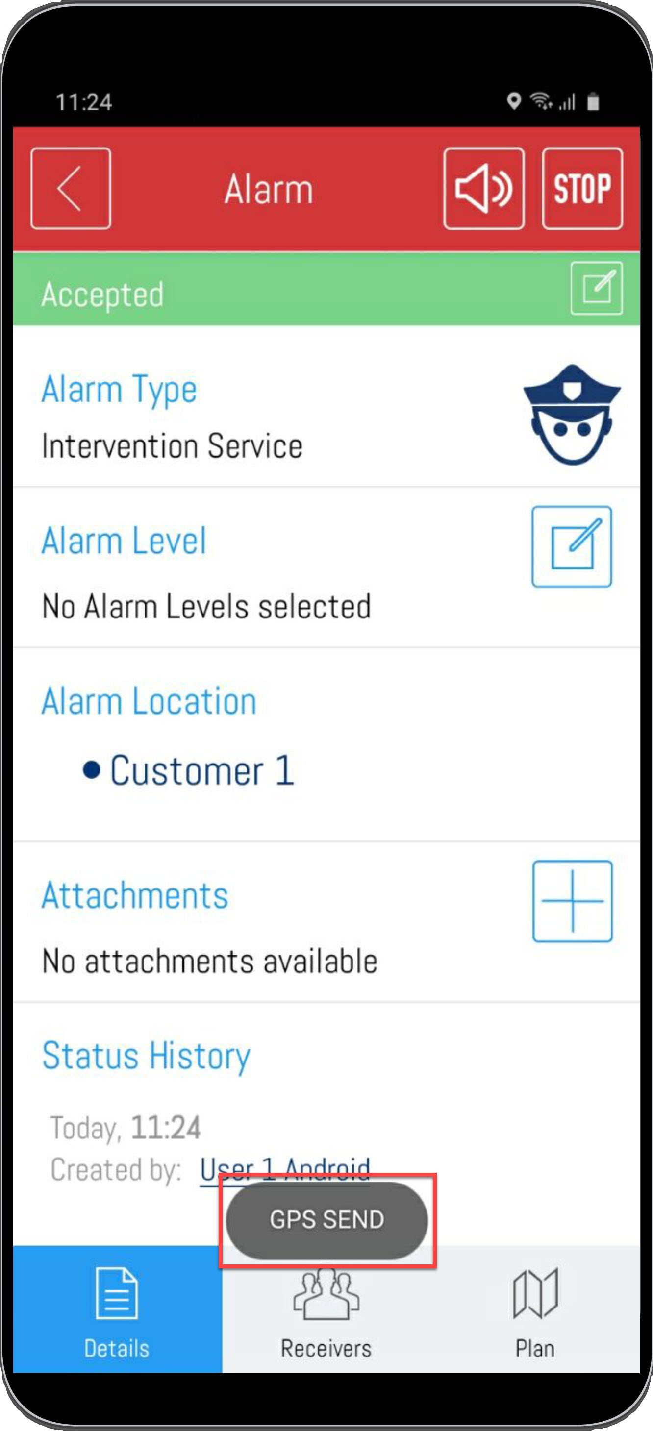
To start the GPS function of the intervention service, the corresponding intervention alarm must be accepted upon receipt.
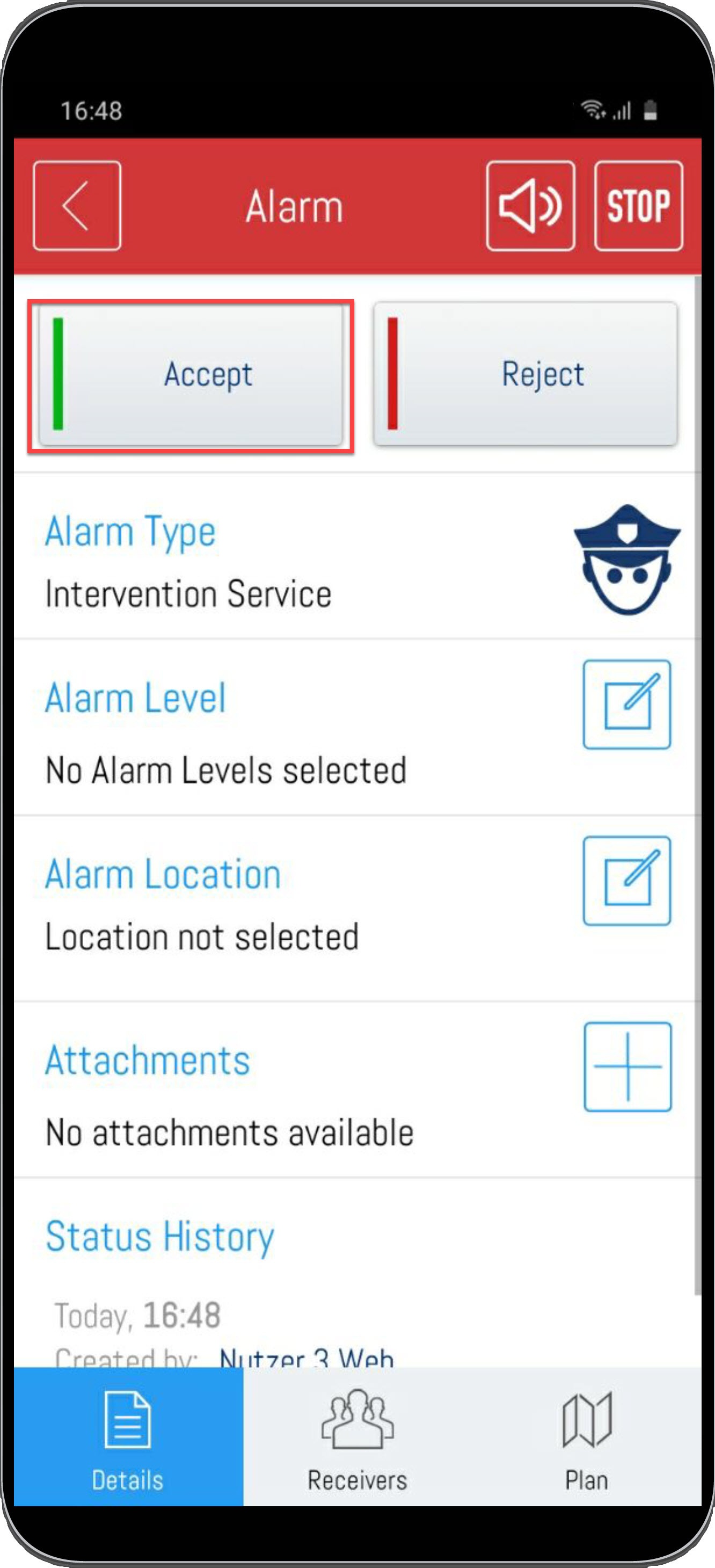
As soon as the alarm is accepted, the location service is started and the documentation begins. The "GPS" icon in the top push bar of your smartphone indicates that the service is active. Also, after the acceptance, the info fields "LocationService started" and "GPS send" will be displayed to indicate that everything is working properly.
For the mobile documentation of the intervention service, a smartphone with GPS function is required. Documentation via our web cockpit is not possible with a PC only.
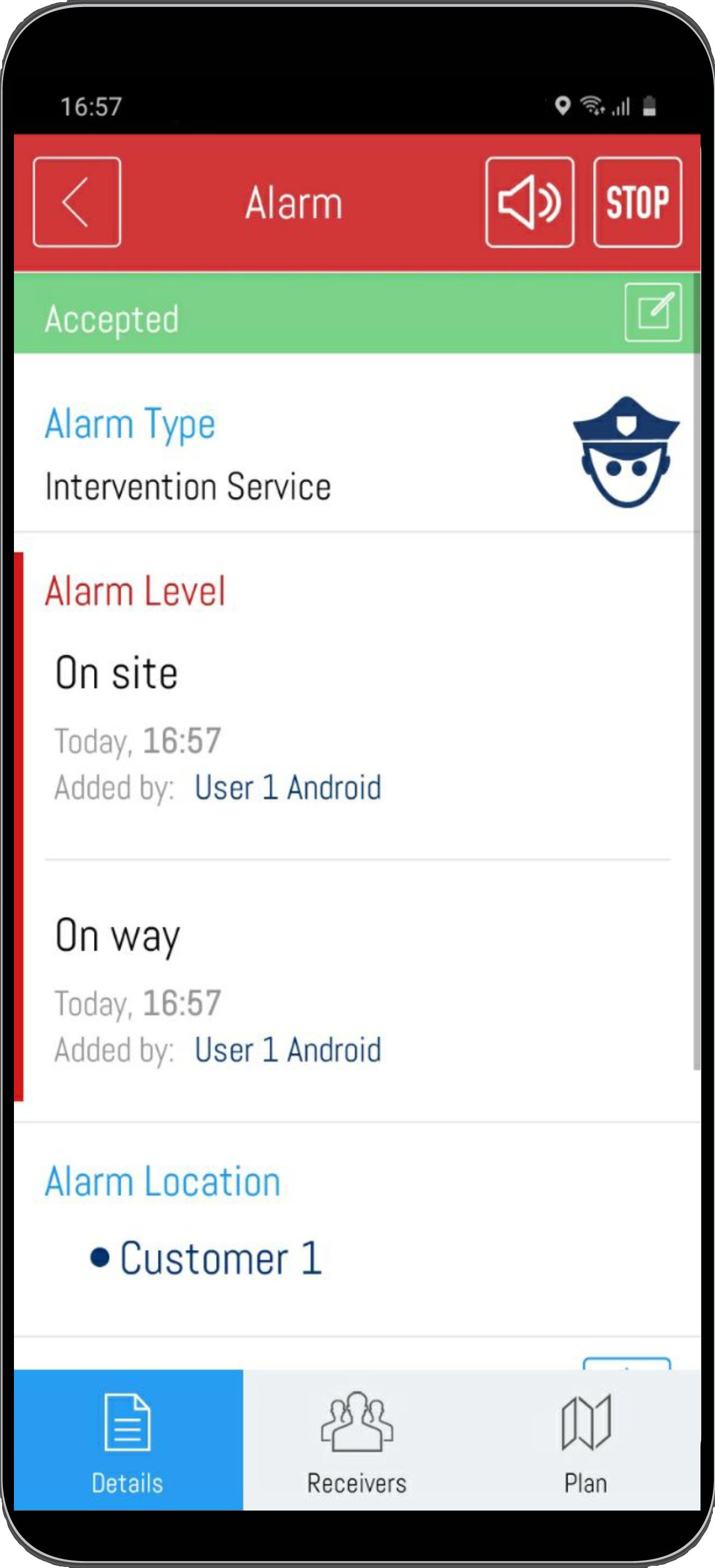
Automatic Alarmlevels
With the intervention module, alarm levels can be triggered automatically.
This allows automated documentation when an intervention force is on its way to the object or arrives at the object. A corresponding configuration must be created for this. You can find out how to make this configuration here under 3.5 Setting up the intervention service.
The alarm level set for the way to the target object is automatically selected when the user who accepted the alarm is 100 meters away from his acceptance position.
The alarm level set for arrival at the destination is automatically triggered when the user is within a radius of 300 meters from the destination.
Documentation via WEB-Cockpit
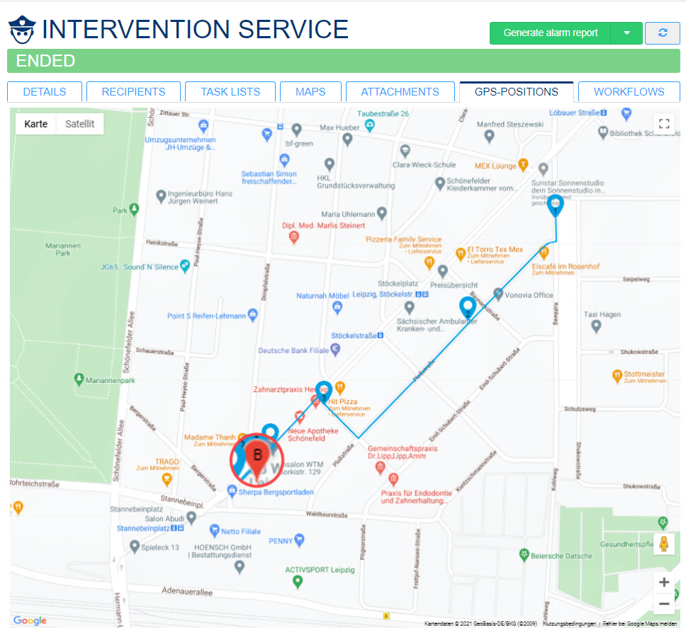
After the intervention has been started by accepting a user, the position is transmitted to EVALARM every minute. The user's route and the associated time stamps can be viewed in the web cockpit directly during the alarm. Even after termination, the alarm including all data is documented in the web and can be viewed. If you have the appropriate authorization, you can also generate an automatic alarm report directly here as usual.
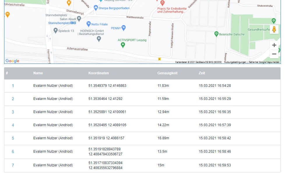
Alarm route
The user's route is created from the transmitted coordinate points. The red pin marks the target object.
If several users accept the alarm at the same time, the GPS pins will be displayed in a different color for each user.
Überblick
Inhalte